INT-NAV
1. Brief Description
– see PP presentation
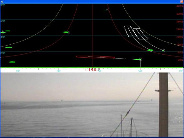
– Display type: INT-NAV monitor ( Video image + information for collision avoidance support)
2. Functional Capabilities (types of data à information content)
– INT-NAV shows video image of seascape on a lower part of display.
– INT-NAV shows target information such as RADAR image, relative position, future track and collision danger zone on an upper part of display.
– The target information is plotted the distance from own ship vs. the direction of own ship.
– The silhouette of target ship and its information is directly linked vertically.
– The danger zone is calculated with OZT algorism (proposed by Prof. Imazu, Tokyo university of marine science and technology )
3. Intended Purpose
– combine visual, radar, ARPA data, AIS data, future maneuver of target and collision danger zone onto a display
Benefits:
– INT-NAV provides up-to-date target information
– INT-NAV shows the future tracks and collision danger zone of each target ship.
– The collision danger zone provides danger heading, which makes it easy to find safe heading to avoid all target ships.
4. Portrayal examples
a) good examples
– image of INT-NAV with radar and ARPA information and collision danger zone.
b) lessons-learned
– Displaying collision danger zone in the coordination of distance from own ship vs. direction of own ship graph makes it easy to find safe alternative direction in decision making of collision avoidance maneuver
– Horizontal link between silhouette of target ship and its information is effective to fine collision danger ship from seascape.
– control brightness is essential
c) some concerns


